Part V: Lofoten to Tromsø
挪威自驾游之五:从罗弗敦到特罗姆瑟
The west coast of North Norway is a paradise for travel lovers.
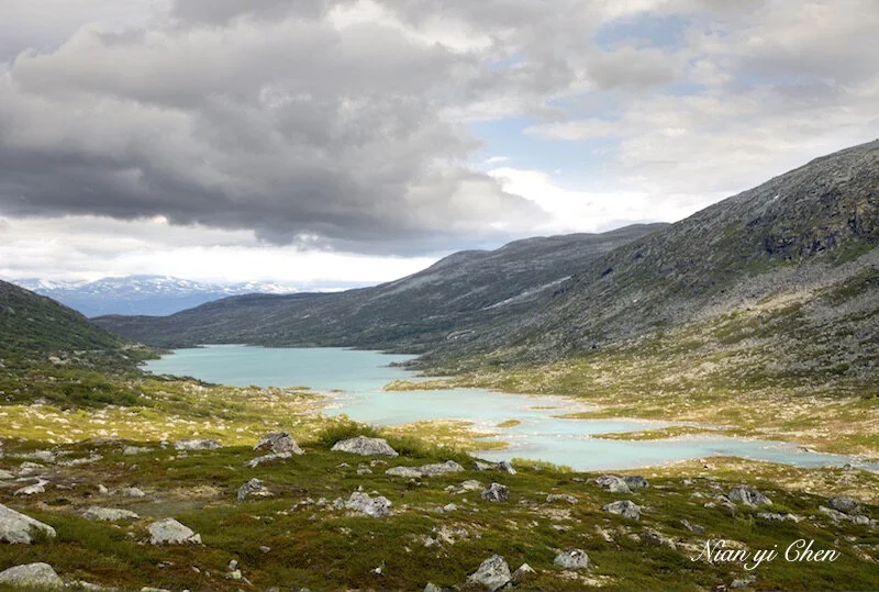
Nordland is a county in North Norway. It has an endless rugged coastline with thousands of islands. Lofoten archipelagos (islands) especially have astonishing landscape - the dramatic combination of the unique mountain peaks by the blue sea, the colorful fishing villages and the peaceful beaches.
挪威北部的西海岸是旅行爱好者的天堂。 诺德兰(Nordland)是挪威北部的一个县。 它有崎岖的海岸线和成千上万个岛屿。 罗弗敦群岛(Lofoten)是诺德兰的一部分,它的景观令人叹为观止:蔚蓝色的大海,色彩缤纷的渔村和奇异的山峰形成了戏剧性的结合。


The famous Lofoten was our first stop in North Norway. We followed the direction of the web site “Norway’s Tourist Routes” (https://www.nasjonaleturistveger.no/en/routes/lofoten ) and did our 5 day self-driving in Lofoten Islands, which was quite a life time experience.
著名的罗弗敦(Lofoten)是我们在北部挪威的第一站。 我们循“挪威国家旅游路线”(https://www.nasjonaleturistveger.no/en/routes/lofoten)的指引,在罗弗敦作了为期5天的自驾游。这是毕生的难忘之旅。

Lofoten from the sky 空中俯瞰
Though Lofoten is one of the best places to watch the northern light, its summer is also fantastic. The temperature is comfortable and the water is so green! Since all the roads are open in the summer, one can easily visit most of the islands. The only disadvantage of visiting here in the summer is that you can hardly catch the twilight (giving best photos), because the sun never sets.
尽管罗弗敦(Lofoten)以观赏北极光著称,它的夏天也非常迷人, 气温舒适,碧水蓝天。 由于所有道路都开放,游人可以轻松涉足大多数岛屿。 但夏天到此旅游的缺憾是,由于太阳永不落山,所以难以捕捉到清晨或日暮的微光景色。
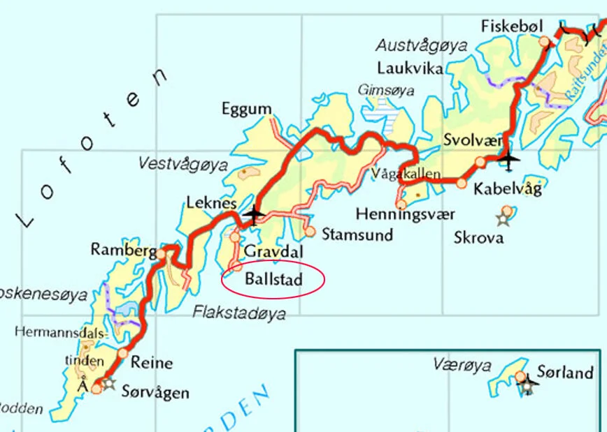
We flew into the capital of Lofoten, Svolvær on July 2, 2019 and drove through most of the islands and scenic spots in Lofoten, including Grunnfor, Eggum, Leknes, Ballstad, Nusfjord, Ramberg, and Reine.
我们于2019年7月2日飞抵罗弗敦的首都,斯沃尔韦尔(Svolvær),驱车穿越了罗弗敦的大部分岛屿和风景名胜区,包括格伦福,艾格姆,莱克内斯,巴尔斯塔德,努斯峡湾,拉姆贝格和雷纳。

The red line on the map is E10, European Route 10, that connects all the islands in Lofoten.
地图中的红线是E10号公路(欧洲10号)。它贯穿罗弗敦的主要岛屿。

Arriving Svolvear
This is a really small airport. We picked up our rental car upon arrival and drove out of Svolvær on the same day.
斯沃尔韦尔机场非常小。我们在此提取了预定的租车后就在当天离开了斯沃尔韦尔。

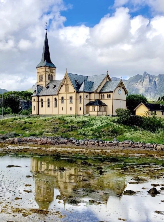
Kabelvåg Church
Immediately outside of Svolvær, there is Kabelvåg Church. it was also nicknamed as the “Lofoten Cathedral”. According to Wikipedia, “This has been a church site since the 12th century… Five or six different churches have been built on this very location throughout the last 900 years.” “This present church was built in 1898 to be large enough to accommodate all the fishermen who came to Kabelvåg each season.”
在斯沃尔韦尔(Svolvær)外围不远处有一个卡贝尔沃格教堂(Kabelvåg Church)。 它也被昵称为“罗弗敦大教堂”。 根据维基百科,“自12世纪以来,这里一直是教堂所在地。在过去的900年中,在此建造过五六个不同的教堂。” “目前这个教堂建于1898年,其大小足以容纳每个季节来到卡贝尔沃格的所有渔民。”
Kabelvåg Church
Unique seaside mountains and colorful cabins on the sea shore is a typical scenery in Lofoten.
罗弗敦(Lofoten)的典型风景是奇特的海边山脉加岸边色彩斑斓的小屋。

What caught our attention first was Norwegian’s interesting fishing industry. Dried fish heads were every where to catch the attention of tourists.
渔业文化是首先映入到访者眼帘的一道独特风景。 干鱼头到处吸引着游客的目光。

到处可见晾晒的鱼头


Fish farm (above and below) 养鱼场(上下图)


The red rorbuors (above) are everywhere in Lofoten. They used to be fishing huts during the fishing season. Now, many of them were turned into vacation rental cabins.
罗弗敦处处可见红色的小板房(上图)。 他们过去曾经是捕鱼季节的渔人小屋,现在其中很多变成了出租度假屋。


In Lofoten, there are many of these bridges (above) which connect island to island.
在罗弗敦,有许多这样的桥梁把诸多岛屿连接起来。
From Svolvear (Svolvær), we first drove northwest to Eggum, a fishing village lies on the seaside of Vestvågøy island.
我们首先从斯沃威尔 (Svolvær) 向西北开往艾格姆 (Eggum),这是一个位于Vestvågøy岛上的海边渔村。

There is a gate at the entrance of Eggum village. Some 100 NOK entrance fee was required. We debated whether to enter or not, but were glad that we did. The lush meadows with blooming wild flowers between mountains and the sea took our breath away.
Eggum的村口处有一个自动收费处,游客大约需要投入150挪威克朗。 我们曾犹豫是否要进去,后来庆幸没有省这个钱:)高山和大海之间有着郁郁葱葱的草地和村庄,盛开的野花点缀其间。其情景让人流连忘返。

There is some sort of stone structure like an amphitheater in the end of the road. Many people were picnicking and camping there or waiting for sunset.
村中小路的尽头有类似露天剧场的石头建筑。 许多人在这里野餐,露营或等待日落。
Near Eggum, there is another seaside village, Unstad, that is also very beautiful!
埃格姆(Eggum)附近有另一个海滨村落,Unstad,也很漂亮。(下)

Coming back from the north shore, we drove by the town of Leknes in the central area of Lofoten. It is a prosperous town as the trade and shopping center of Lofoten where you can easily find lodging and restaurants.
从北岸回来,我们途径罗弗敦中部地区的莱克内斯(Leknes)镇。 这是一个繁荣的小镇,一个相当规模的贸易和购物中心。这里有北部挪威有名的渔业博物馆和维京博物馆,而且很容易在此找到住宿和餐厅。

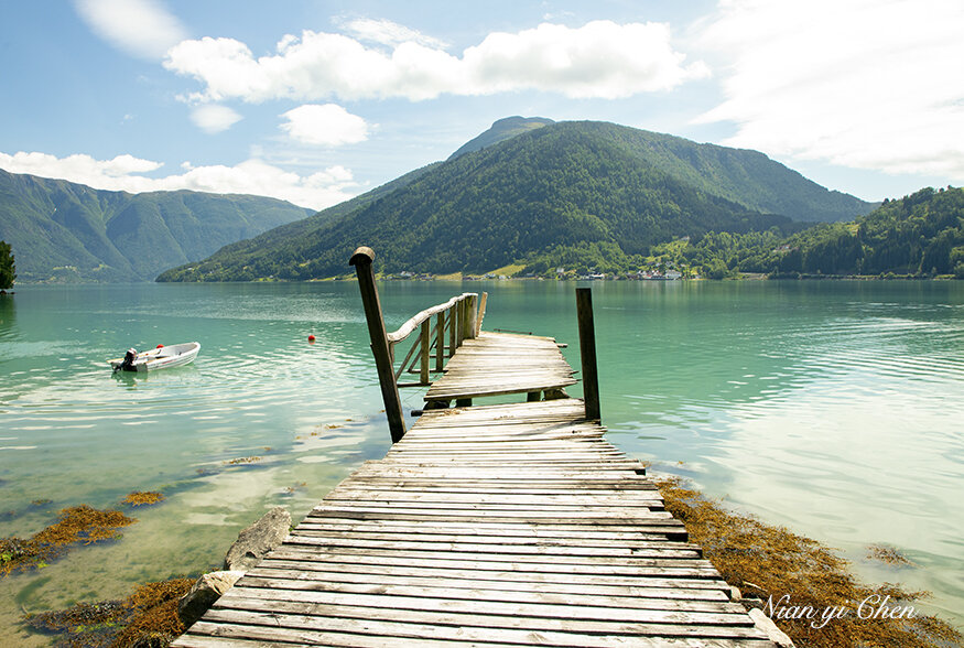
This lake near Leknes is so beautiful with a small boat docking in the center.
近旁有恬静迷人的湖泊


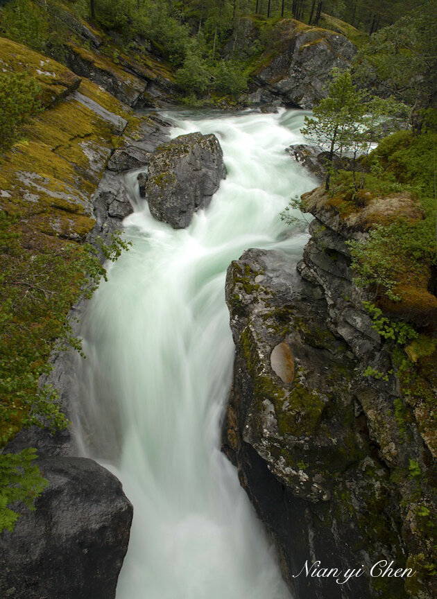
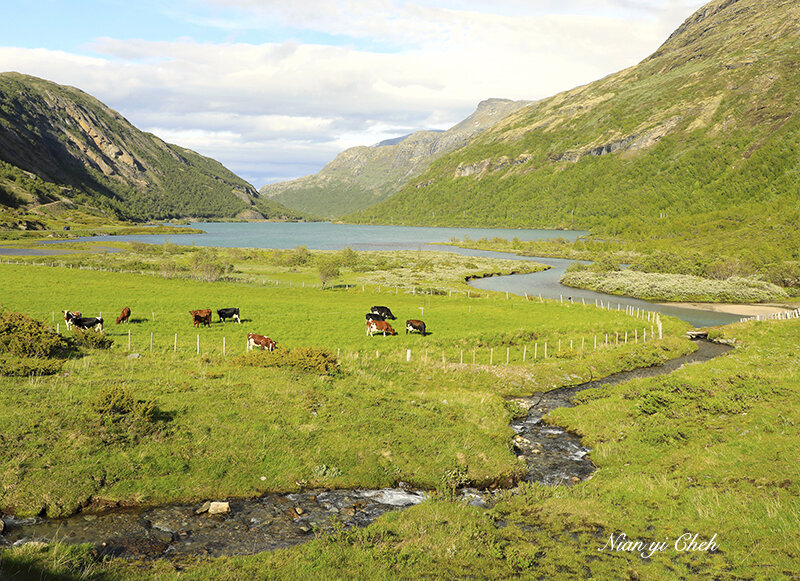
Driving from one place to another in Lofoten also means you experience the drastically different landscape, from peaceful meadows and swamps to dramatic mountain scenery.
在罗弗敦从一处开车到另一处也意味着体验截然不同的风景,从宁静的沼泽到雄伟粗旷的山峦。

From Leknes to Ballstad 从莱克内斯到巴尔斯塔德


Where we stayed for the first night in Lofoten is a fishing village called Ballstad. This is such a tranquil and beautiful place!
我们在罗弗敦住了第一晚的地方是一个叫做Ballstad的渔村, 这是一个那样宁静而美丽的地方!

It was sunny when we arrived Svolvear, but it started raining in the evening when we were looking for a place to stay. (I lost my hotel reservation)
我们下午到达Svolvear时还天气晴朗,但傍晚当我们寻找住宿地点时却开始下起雨来。 由于丢失了住宿预订,当晚的投宿颇费了一番周折。

The rain stopped the next morning. 次日雨过天晴。

From Ballstad to Reine. 我们从巴尔斯塔德前往雷纳。

On the second day in Lofoten, we came to Reine, the most important photo destination in Lofoten.
雷纳是罗弗敦最著名的摄影胜地

Reine is a fishing village situated on a promontory just off E10 .
这是一个位于E10旁边海角上的渔村。

Reine has been selected as the most beautiful Norwegian village in late 1970s by a Norwegian magazine, Allers.
A magnificent photograph over Reine from the mountain Reinebringen ( 448 m above sea level) has been used as a classic portrait of Reine by several travel magazines. Unfortunately, hiking that mountain is not suitable for us. Using a drone to take the pictures of Reine provided some sort of compensation for us.
雷讷(Reine)被挪威杂志《 Allers》选为1970年代后期最美丽的挪威村庄。
数本旅行杂志曾将附近的雷讷布林根山(Reinebringen)上的拍摄的雷讷风景照作为罗弗敦的经典肖像。 不幸的是,我的体力不足以攀登那座山,只好用无人驾驶飞机摄影来作为某种补偿。


We’ve got one and a half sunny days in Lofoton, which allowed us to record the amazing color contrast of this beautiful place.
我们在罗弗敦获得了一天半的晴天,这使我们有机会记录下这里令人惊艳色彩对比。


覆有茵茵绿草的屋顶再次显现芳姿

Reine


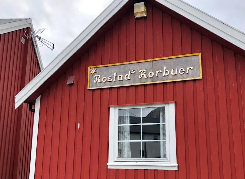

Above and below are Rostad Roebuer, a place we stayed in Reine for one night.
我们在Rostad渔民小屋度过了在雷纳的第一晚
The surroundings of Rostad Rorbuer were very nice, except our cabin wasn’t too good.
周遭的风景很美,可惜我们的小屋不怎么样。

View from the cabin


Dried fish heads

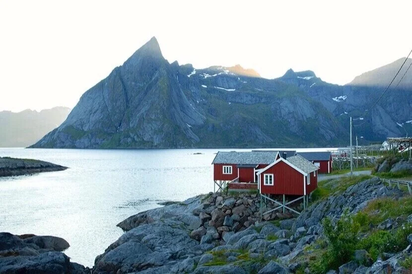
The above and below are the views from Hamnøy Bridge that is perhaps the most popular photography location in Lofoten. Looking over a collection of red Rorbur with the Festhelltinden mountain looming behind .
上图和下图是从雷纳的Hamnøy桥上所见的风景,这可能是罗弗敦最受欢迎的摄影场所。 红色的渔村和后面的高耸Festhelltinden山尽收眼底。

The second night in Reine, we stayed in a rental house in Reinehalsen, which was much better! Below are the views from the house.
在雷讷的第二个晚上,我们住在雷讷哈尔森(Reinehalsen)的一间出租房里。这一间条件要好得多! 下图是屋外的景色。


3 am after sunrise 凌晨三点的窗外

After exploring the south part of Lofoten Islands, we started to head back to the central and northern areas of Lofoten Islands. Before reaching Nusfjord, we first hit Ramburg a hub town sitting on the main road, E10.
在探访了南部罗弗敦之后,我们开回到群岛的中部和北部地区。 在前往努斯峡湾之前,我们先到达了位于E10公路上的枢纽小镇,拉姆贝格。


Ramberg 拉姆贝格
The long white sand beach and the green water make Ramberg like a paradise.
长长的白沙滩是拉姆贝格标志性的景点

Ramberg fish farm 拉姆贝格养鱼场

After Ramberg, we made a right turn on E10, a country road led us to Nusfjord, a famous historical fishing village.
在拉姆贝格之后,我们从E10公路转上一条乡间小路来到著名的古渔村努斯峡湾(Nusfjord)。

Road to Nusfjord 去往努斯峡湾的路边景色
Nusfjord is one of the oldest fishing villages in the Lofoten Islands. Buildings in the village can date back to 1800s or early 1900s. Tucked behind a huge rock, the village is situated in a calm bay, tranquil and cozy. It is now a tourism destination with all the fishing huts remodeled into vacation rentals.
努斯湾是罗弗敦群岛最古老的渔村之一。 村庄的房屋建筑可以追溯到1800年代或1900年代初。 渔村隐蔽在一个大岩石后面,海湾内显得热闹而祥和。 现在,努斯湾已成为一个旅游胜地,小渔屋便都改建成了度假屋。内部装修很漂亮哦!


Historical buildings became the nesting sites for gulls.
Today’s Nusfjord village is used as an open-air museum, complete with a cod liver refinery, fish market, and stores that sell various historical artifacts.
今天的努斯峡湾村被用转型为露天博物馆,内有曾经的鱼肝油提炼厂,老鱼市和历史文物商店。 捕鲸是挪威北部的一项古老传统,冬天那里的食物稀少。 如今,仍保留着小规模的捕鲸活动。 人们被允许食用一些鲸鱼肉。
In the village there is a wonderful restaurant where, for the first time, we tasted a whale stake that was really delicious.
这村子里有一家很棒的餐厅,我们在这里第一次品尝到了美味的鲸鱼排。

Whale stake
Whale hunting is an old tradition in North Norway, where food is scarce in winter. Today, small scale of whale hunting is still remaining. People are allowed to consume some whale meat.
捕鲸是北部挪威的古老传统。这里漫长的冬天使食物匮乏,鲸鱼肉便成为人们赖以生存的营养来源。 如今这里仍保留着小规模的捕鲸活动,人们可以少量食用一些鲸鱼肉。
After Nusfjord, we spent a night in Svolvær and prepared for leaving Lofoten Islands.
努斯峡湾过后,我们继续向东北驶向首都斯沃尔韦尔

Hanningsvear, Lofoten 途径汉宁斯维尔

我们在斯沃尔韦尔逗留一晚后离开罗弗敦群岛,前往更为北面的塞尼亚。
North to Svolvear, we explored two more pretty spots, Grunnfør (beaches, swamps and birds) and Austnesfjorden.
在斯沃尔韦尔(Svolvaer)北部,我们探访了另外两个罗弗敦景点,格伦弗(Grunnfør)和奥斯特菲约登(Austefjorden)。
格伦弗有美丽的沙滩,沼泽和飞鸟。


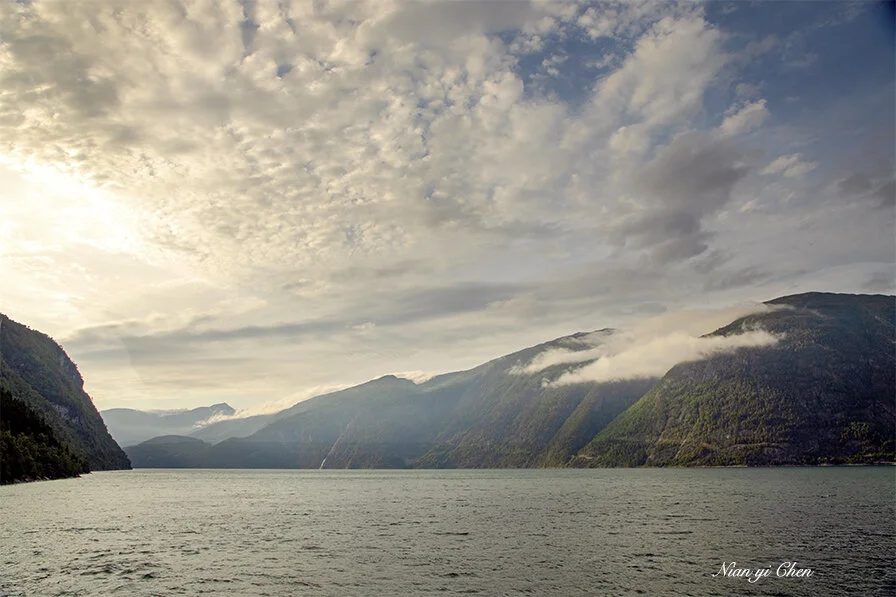
July 6, from Lofoten, we drove northward to Andenes, the northernmost tip of Vesterålen islands.
7月6日,我们从罗弗敦北上到达维斯特朗岛(Vesterålen)最北端的安德内斯(Andenes)。

Although under the shadow of Lofoten, the remote Vesterålen islands still awed us.
虽然被罗弗敦的盛名所遮蔽,偏远的维斯特洛伦岛依然景色迷人。


From Andenes, we got on the car ferry to go to Senja, another wonderland of North Norway.
从安德内斯,我们乘汽车轮渡前往挪威北部另一个旅游胜地塞尼亚(Senja)。

Senja is also on the list of the 18 National Tourist Routes. Following the direction of the website, https://www.nasjonaleturistveger.no/en/routes/senja, we drove through the spots of highlight such as Gryllefjord, Skaland and Tungeneset.
塞尼亚(Senja)也被列入在挪威的18条国家旅游路线中。 循该网站https://www.nasjonaleturistveger.no/en/routes/senja的指引,我们浏览了Gryllefjord,Skaland和Tungeneset等景点。

Gryllefjord
After spending days in Lofoten and Vesterålen islands, we still find Senja very special and attractive! Its blue fjords, sculptural rocks, and colorful villages made us regret not having enough time here.
在经历了罗弗敦和维斯特洛伦岛之后,我们依然发现塞尼亚(Senja)非常特别而且迷人! 它的蓝色峡湾,雕刻般的岩石和色彩斑斓的村庄使我们为匆忙的行程感到遗憾。
Hotel Hamn I in Gryllefjord near the ferry dock would be a very nice place to stay . The location is convenient and the surrounding is so beautiful! Unfortunately, we didn’t have a reservation there.

Gryllefjord
Skaland 斯卡兰德

Skaland
Tungeneset (below) is one of the most impressive attractions we visited in Norway. It lies on the tip of the promontory between the Steinsfjord and the Ersfjord. A nice wooden walkway leads out over the rocks to provide a view to the Northern Sea in the west and the mountain Oksen with the sharp peaks in the north.
斯卡兰德辖区内有一个叫Tungeneset(下图)的海边公园。这是我们在挪威参观过的最令人印象深刻的景点之一。 它位于斯坦因峡湾和埃尔斯峡湾之间的海角顶端。 一个考究的木制人行道通向一个又长又宽岩石海滩,走在高低起伏的岩石海滩上你可以欣赏到西面的北大西洋和北面奇峰突起的奥克森山。

Tungeneset

Tungeneset

Tungeneset

Senjahopen
After spending a day in Senja, we took ferry from Botnhamn (east side of Senja) and sail to Brensholmen, then drove to Tromso.
在塞尼亚岛度过一天一夜之后,我们乘渡轮航行至特朗姆郡(Troms)的Brensholmen,然后驱车前往目的地特朗姆瑟(Tromso)。

We arrived Tromso on July 7, 2019.
我们于7月7日抵达了特朗姆瑟

Kvaløysletta near Tromso


Tromso